
Cruise ship indoor navigation in 2026: deck maps, pins and wayfinding
TL;DR
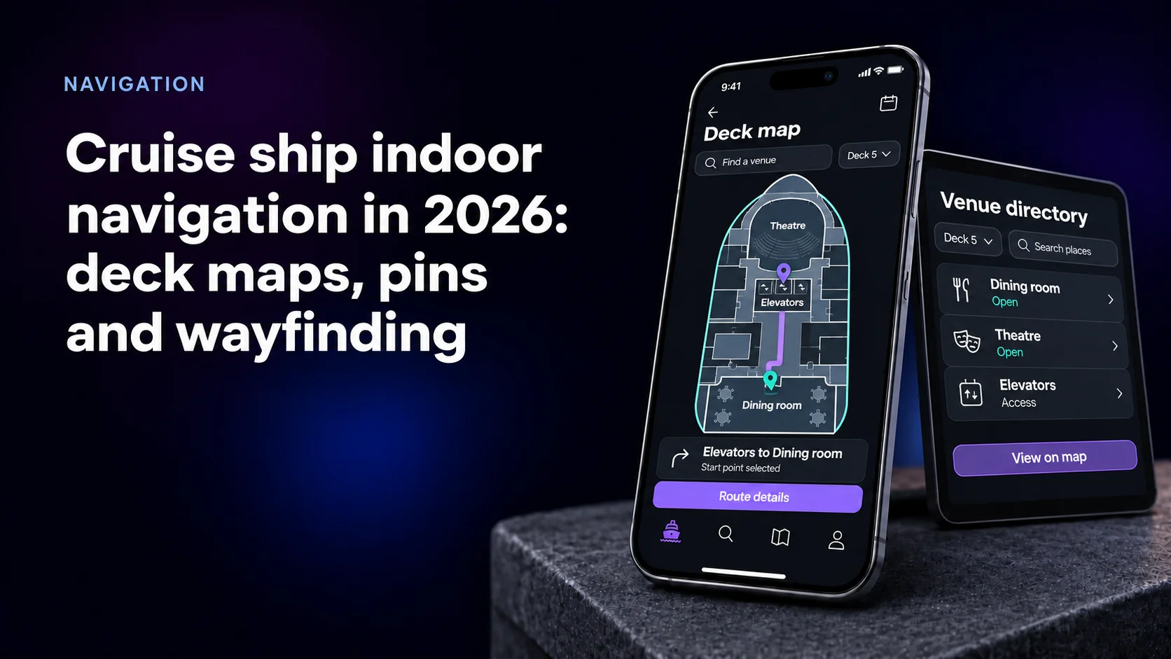
Cruise ship indoor navigation in 2026 is a data problem before it is a positioning problem. A deck map exported as a PNG can show deck 5, but it cannot search, translate, resize its labels, show what is open or draw a route.
- OnDeck's 2026 review of 21 ocean cruise apps found deck maps in nearly every app; one operator swapped Mapbox for the open-source MapLibre.
- Build the map as data: decks and venues with stable IDs, in a GeoJSON model such as Apple's IMDF, an OGC Community Standard since 2021.
- Ship routing first. A guest can pick a start point or scan a code at the elevator, with no beacons installed.
- Positioning comes last and costs the most: MSC put over 3,500 beacons on each smart ship, and Royal Caribbean's Icon of the Seas runs location over 4,000+ Wi-Fi access points.
Why a PNG deck map stops working
Every cruise app now has a deck map. An image answers one question: what is on deck 5. Guests ask others. Where am I? Which bar is open? How do I reach the theater in a wheelchair?
MSC Cruises' Luca Pronzati told Cruise & Ferry that many guests left the ship without visiting every venue because they could not find them. MSC's answer was an interactive map that guides guests to any public venue. GPS cannot help: per Pole Star, satellite positioning does not work below deck.
What the 2026 cruise app report found in the map layer
The 2026 Cruise Mobile Apps report from OnDeck by Sourcetoad analyzed 21 ocean cruise apps:
- Deck maps are in nearly every app; the better ones are interactive and searchable.
- Mapbox still dominates. One large operator's build grew by nearly 100 megabytes as its Mapbox integration expanded; another replaced Mapbox with MapLibre.
- IndoorAtlas, which positions phones by the magnetic field, appeared in one operator's app.
- One app shows the travel party's location with wayfinding.
The publisher runs four of the 21 apps, and says so. The MapLibre switch is about licensing: when Mapbox closed the license of its library in December 2020, the community forked the last open version, per MapTiler.
How we put this guide together
We read the three pages that answer this topic in AI search. Pole Star sells safety-first indoor location with passenger navigation as one solution. Safectory sells BLE beacons and tracking software. Seatmap sells cabin charts for booking. None covers map data, label accessibility or what happens to a pin when a venue moves. Mercury Development builds cruise apps, so read the build advice as an interested view.
Four kinds of deck map at a glance
| Map | What the guest gets | What a venue rename costs | Needs on board |
|---|---|---|---|
| Image (PNG, PDF) | A picture to zoom | A new image per deck per ship | Nothing |
| Vector map with real labels | Search and resizable labels | One data edit | Map data in the app or on a ship server |
| Vector map with pins | What is open, where, now | One venue record | Venue and schedule feeds |
| Routing and blue dot | Directions and "you are here" | Data edit plus route check | Route graph, then positioning |
Most lines can reach the third row without new hardware.
Make the deck map data, not a picture
Model each deck as a level, each venue as a unit with a stable ID, each door as an opening. That is the vocabulary of Apple's Indoor Mapping Data Format, which the OGC approved as a Community Standard on February 2, 2021. IMDF features are GeoJSON, with an extension model for industry-specific types.
A ship adds one catch. RFC 7946 fixes GeoJSON coordinates to WGS 84 longitude and latitude, and a ship moves. Pin the model to a fixed, arbitrary origin, author it in ship terms such as deck and frame, and never let the map follow the ship's real position.
Render it with MapLibre, which is BSD-licensed, or commercial Mapbox. Both draw vector data on the phone, so the map works on ship Wi-Fi without a satellite link. Keep one venue ID across the map, schedule and folio.
Labels and accessibility decide the format
WCAG 1.4.5 asks for real text instead of images of text whenever the app can render it. Venue names baked into a PNG fail. So does an SVG loaded as an image, per a W3C test rule. Pins are tap targets, with a WCAG 2.2 AA minimum of 24 by 24 CSS pixels.
In Europe this is law. Since 28 June 2025 the European Accessibility Act has covered apps of waterborne passenger transport services, including cruises embarking in an EU port.
Pins: one venue record, many screens
A pin is a view of a venue record, never something drawn by hand.
- Feed pins from the systems that own the facts: hours from hotel operations, events from the daily schedule, closures from maintenance.
- Group overlapping pins. MapLibre clusters points with one option and a 50-pixel default radius.
- Search across decks. "No results" on deck 5 while the venue sits on deck 14 loses the guest.
- Put "Show on map" on every schedule item and reservation.
Wayfinding before the blue dot
Routing needs a graph, not a sensor. Nodes are doors and elevator lobbies; edges carry walking times. Exclude crew-only links and flag step-free paths.
The start point can come from the guest: "my cabin", a venue, or a code scanned at the elevator lobby. That ships with no beacons, and the graph stays when positioning arrives. Use the same graph for the touchscreen kiosks that Cruise Critic calls standard on new ships, so app and kiosk never disagree.
Positioning: what each option needs on board
- BLE beacons. MSC Meraviglia launched with 3,050 beacons and five-meter wayfinding precision, per Future Cruise. Pronzati said pool water made the signal jump between decks: floor detection is the hard part.
- BLE read by Wi-Fi access points. On Icon of the Seas and Star of the Seas, Pole Star's case study uses 4,000+ BLE-enabled Cisco access points for room-level location, on a server aboard, streamed to the passenger app.
- Magnetic positioning, as IndoorAtlas does with the phone's own sensors.
- Bluetooth Core 6.0 Channel Sounding for distance measurement, per the Bluetooth SIG.
Decide who sees location data before you pick hardware.
Who supplies which layer
| Layer | Options | What you still own |
|---|---|---|
| Map data | IMDF tooling, Mappedin | Venue IDs and links to schedule |
| Renderer | MapLibre, Mapbox | Offline packaging and app size |
| Positioning | Pole Star, Safectory, IndoorAtlas | Consent rules and floor tests |
| Booking charts | Seatmap | Inventory sync |
What our cruise and location work shows
For cruise line clients Mercury cannot name under NDA, we rebuilt a passenger app on React Native, with ship maps and wayfinding among its features. The lessons repeat:
- A product owner could not fix a venue's spelling or font, because the text was part of the PNG.
- Dense decks needed grouped pins with a count.
- Feedback from a real sailing flagged buttons guests missed because the tap area was too small.
- Some behavior reproduces only on a real vessel, as our cruise app testing guide explains.
Our onboard spa platform for OneSpaWorld has run since 2018 on over 160 ships, on ship servers with no external internet. Public cases go further back: Kensington Proximo shows BLE tags on a map, delivered as an Android app in 3 months; Mayday gives admins a live map with perimeter boundaries; GreenLinks switches golf holes by player location.
Treat the deck map as content, not artwork
Buy the positioning network and, if you like, the renderer. Own the venue records, IDs, route graph and the workflow that updates them after a drydock. If nobody in hotel operations can rename a bar on the map, the map will be wrong by the second season.
Ask vendors: "Tonight we rename a bar and close a staircase on one ship. What changes, and how does a guest without an internet plan get the new map?" A team that has done it names one record and a sync job.
Mercury Development, founded in 1999 and based in Fort Lauderdale, has 500+ engineers and builds to WCAG 2 AA and ADA requirements. The customer owns the code and all underlying IP.
Written by Rob Devereaux, Chief Operating Officer at Mercury Development. Rob has run the firm's operations from Hudson, Ohio since 2019 and has over 20 years of operational and financial experience. The cruise project records behind this article's delivery patterns sit in the operations he oversees.
Still shipping deck maps as images? Plan the move to map data
Send us one deck plan, your venue list and the screens where guests look for places today. We will sketch the venue model, the pins your systems can feed and the route graph, and tell you which ship to start on and what can wait for positioning.